Yukon is vast and alive — traditional homelands of First Nations peoples, welcoming communities, powerful rivers, and roads that lead to deeper understanding. This is story-rich travel, where landscapes and people shape the journey.
Extraordinary landscapesMountains, rivers, tundra and endless skies.
◎
Vibrant communitiesWelcoming towns and northern hospitality.
✣
Rich culture and historyFirst Nations, diverse stories, living heritage.
⌖
Real journeysMeaningful travel, at your own pace.
A GLIMPSE, NOT A SUBSTITUTE
A page can suggest the road. It can’t replace it.
Rovebound gives you enough of the Yukon to feel curious — not enough to replace standing beside the river, hearing the gravel under your tires, meeting the people who live here or watching the light move across the mountains yourself.
Go see the real Yukon for yourself. PACK FOR THE STORY. START YOUR ARC IN THE YUKON.
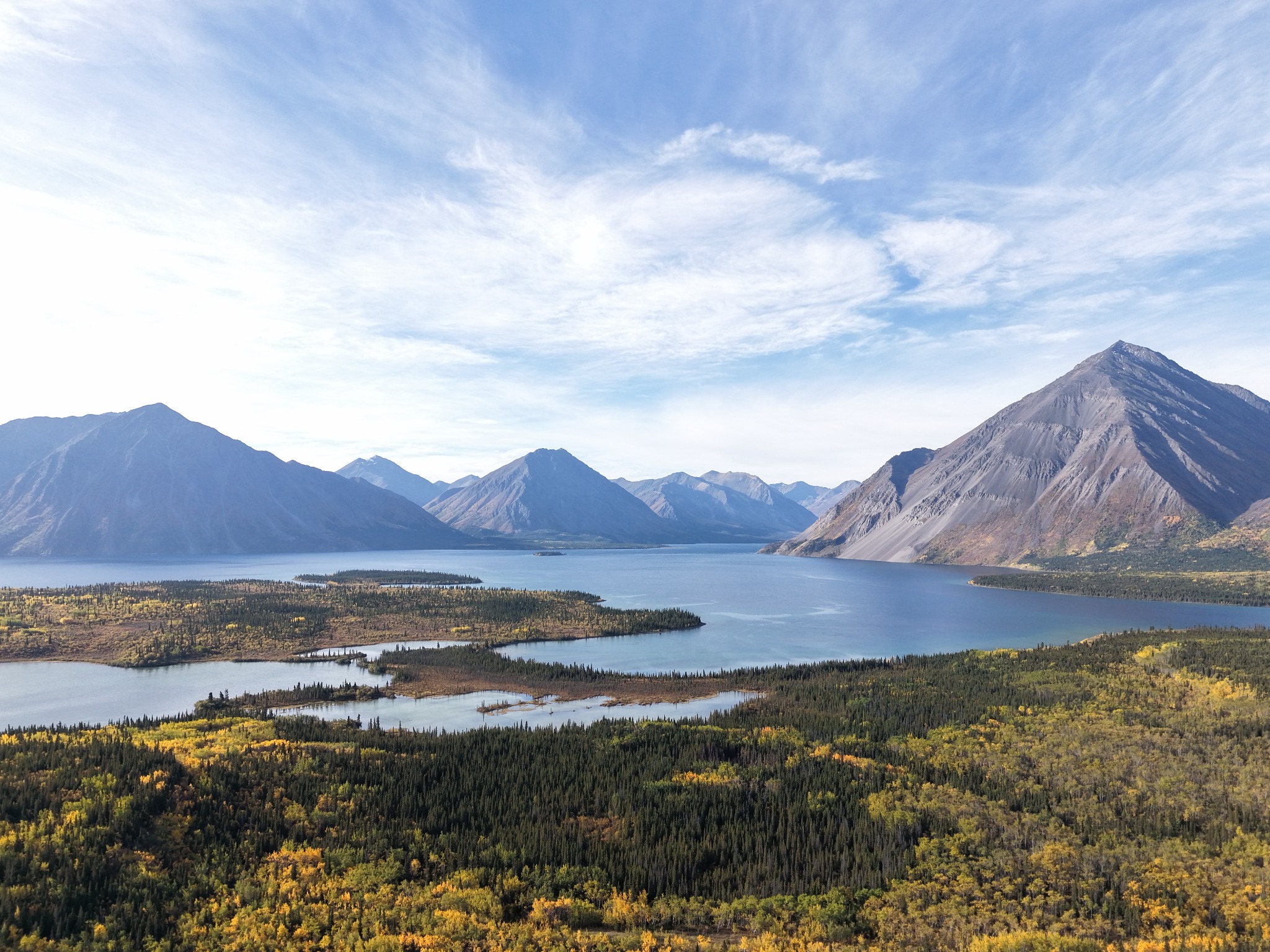
ROVEBOUND FIELD PHOTO · YUKON LAKE COUNTRY
Autumn moves fast up here.Mountain water, evergreen forest and northern colour — a glimpse of the landscape between the roads.
BEFORE THE ROADS
These are living homelands.
Yukon recognizes 14 Yukon First Nations and eight Indigenous language groups. Traditional Territories cover almost all of the territory, and Indigenous peoples, governments, languages and cultures are part of Yukon’s present — not a chapter that ended in the past.
LIVING CULTURE · LIVING GOVERNMENTS
Learn whose homeland you are travelling through.
Eleven Yukon First Nations have modern Final and Self-Government Agreements. Rovebound treats Indigenous history, culture and governance as current context for travel, not decoration.
Editorial rule: ROVO must not invent Indigenous legends, sacred meanings, ceremonial practices, clan symbolism, traditional place names or Indigenous-style art. Nation-specific cultural information should come from the Nation itself or trusted Indigenous/official sources.
The Yukon has been travelled for thousands of years. Rivers were transportation corridors. Lakes and fish camps were gathering places. Mountain passes connected families and trade networks. Modern highways often follow or cross landscapes that were already known, named and moved through long before road construction. When you travel here, the route is new to you — not new to the land.
Carcross/Tagish First Nation
Based in the Southern Lakes, C/TFN describes deep Tagish and Tlingit cultural connections and a worldview in which land, water, animals, ceremony and clan relationships are intertwined. Nation source ↗
Champagne and Aishihik First Nations
CAFN’s homeland stretches across southwest Yukon and into northern British Columbia. Southern Tutchone language, family, clan and relationship to dákéyi — their country — are central to identity. Nation source ↗
First Nation of Na-Cho Nyäk Dun
Based in Mayo and connected to the Stewart River country. The Nation explains Na-Cho Nyäk as “Big River,” a name tied directly to the waterway around which generations travelled and lived. Nation source ↗
Kluane First Nation
The Lhù’ààn Mân Ku Dań — Kluane Lake People — are based in Burwash Landing. KFN describes predominantly Southern Tutchone ancestry with longstanding connections to neighbouring Tlingit, Upper Tanana and Northern Tutchone peoples. Nation source ↗
Kwanlin Dün First Nation
KDFN’s homeland includes the Whitehorse region and headwaters of the Yukon River. Citizens have Southern Tutchone, Tagish and Tlingit backgrounds; the Nation’s name is tied to the rushing water around the canyon now known as Miles Canyon. Nation source ↗
Liard First Nation
Liard First Nation is a Kaska Dena Nation centred around Watson Lake and the Liard River basin. The Nation identifies protection of Kaska language, culture and land as fundamental to its future. Nation source ↗
Little Salmon/Carmacks First Nation
A Northern Tutchone First Nation based in Carmacks, where the Yukon and Nordenskiold rivers meet. Salmon, river travel, trade and seasonal movement remain important parts of community history. Nation source ↗
Ross River Dena Council
A Kaska Dena community centred at Ross River, where the Ross and Pelly rivers meet. Kaska language work is supported by community knowledge holders and the Yukon Native Language Centre. YNLC source ↗
Selkirk First Nation
A Northern Tutchone First Nation based in Pelly Crossing, with deep connections to Fort Selkirk and the Pelly/Yukon river system. Selkirk history records major changes as transportation shifted from riverboats to highways. Nation source ↗
Ta’an Kwäch’än Council
TKC’s name comes from Tàa’an Män, Lake Laberge. The Nation describes Southern Tutchone linguistic affiliation and ancestry that also includes Tagish and Tlingit connections. Nation source ↗
Teslin Tlingit Council
An Inland Tlingit First Nation based at Teslin. TTC uses Haa Kusteeyí — “Our Way” — for the living system of language, knowledge, art, history and relationship with the environment. Nation source ↗
Tr’ondëk Hwëch’in
A Hän First Nation centred in Dawson. Tr’ochëk, at the Klondike/Yukon river confluence, was an important salmon fishing, hunting, gathering and meeting place long before the Klondike Gold Rush transformed the region. Nation source ↗
Vuntut Gwitchin First Nation
Based in Old Crow in the far north, VGFN’s homeland includes Crow Flats and the Porcupine River. The Porcupine caribou herd is deeply connected to culture, food systems and identity. Nation source ↗
White River First Nation
Based in Beaver Creek, WRFN describes Upper Tanana and Northern Tutchone roots across a homeland that extends across the modern Yukon–Alaska boundary. Nation source ↗
The timeline starts long before the Gold Rush and does not end with it. Indigenous presence, trade, colonial disruption, transportation, modern treaty-making and living self-government all shape the Yukon people travel through today.
SHORT DOCUMENTARY STORY
Before the highways were numbered, the land already had routes.
Rivers connected families. Mountain passes carried trade. Lakes were gathering places. Trails followed animals, seasons and generations of knowledge.
Archaeological evidence at Bluefish Caves in northern Yukon has been interpreted by researchers as possible human activity dating to about 24,000 years ago. That interpretation has played an important role in the scientific debate over the earliest human presence in North America, so Rovebound presents it as evidence under study rather than an uncontested date.
Long before the Klondike became famous, Indigenous trade and travel networks crossed the region. The Chilkoot corridor was used before stampeders arrived. Gold discoveries at Fortymile in 1886 and on Rabbit Creek — later Bonanza Creek — in 1896 accelerated enormous change. Dawson grew rapidly; Tr’ondëk Hwëch’in people were displaced from Tr’ochëk as the rush transformed their homeland.
Yukon became a separate Canadian territory in 1898. The White Pass & Yukon Route reached Whitehorse in 1900. In 1942, the pioneer Alaska Highway was pushed across the northwest in roughly nine months; official histories also record the importance of local First Nations knowledge and guides. Whitehorse replaced Dawson as territorial capital in 1953.
Another transformation was led by Yukon First Nations. In February 1973, Yukon First Nations leaders presented Together Today for Our Children Tomorrow to Canada. The Umbrella Final Agreement was signed in 1993. Today, 11 Yukon First Nations have Final and Self-Government Agreements.
The story is still happening. Learn the names. Meet the communities. Leave room for what the road cannot tell you.
Yukon timeline12 moments
DEEP TIMEBeringia and northern Yukon
Bluefish Caves contains evidence interpreted by researchers as human activity around 24,000 years ago. Rovebound keeps the scientific uncertainty visible rather than presenting a debated archaeological interpretation as absolute fact.
Indigenous peoples travelled, traded, hunted, fished and maintained relationships across the region that is now Yukon, Alaska, British Columbia and the Northwest Territories.
PRE-1800s → 1800sTrade corridors connect coast and interior
Mountain passes and river systems connected coastal Tlingit trade networks with peoples of the interior long before Gold Rush stampeders used routes such as the Chilkoot corridor.
Gold on Rabbit/Bonanza Creek triggers the Klondike rush. Dawson explodes into a boomtown while Tr’ochëk and surrounding Indigenous life are profoundly disrupted.
1898Yukon becomes a separate territory
Canada creates Yukon as a separate territory, with Dawson serving as the territorial capital.
1900Rail reaches Whitehorse
The White Pass & Yukon Route connects the coast to Whitehorse and changes how people and goods move through the south.
1942The Alaska Highway changes movement again
The pioneer road is completed during the Second World War in roughly nine months. First Nations guides and local knowledge help crews understand country unfamiliar to many outside workers.
1953Whitehorse becomes capital
Yukon’s territorial capital moves from Dawson to Whitehorse.
1973Together Today for Our Children Tomorrow
Yukon First Nations leaders present the landmark document to Canada, beginning a modern land-claims negotiation process that reshapes governance in the territory.
1993Umbrella Final Agreement
The UFA is signed, providing the framework for modern Yukon First Nation Final and Self-Government Agreements.
TODAYThe story is not over.
Eleven Yukon First Nations have Final and Self-Government Agreements. Indigenous languages, governments, art, land stewardship, harvesting, community life and cultural revitalization belong to the Yukon present and future.
Open only the moments you want, or collapse the entire timeline into one row.
1 Alaska2 Klondike3 Haines4 Robert Campbell5 Dempster6 South Canol7 Atlin8 Tagish9 Top of the World11 Silver Trail
YUKON · COMMUNITY MAP
Hover a town.
Its name, story, photo and coordinates will appear here.
ROVEBOUND INSTINCT
The Yukon map stays fixed in place. Highway names follow their road geometry, town names appear on interaction, and each community opens a location-specific photo without bringing back pan, zoom or live tile loading.
A place does not need to be famous — or large — to matter to the journey. Mount Lorne, Stewart Crossing, Johnson’s Crossing, Eagle Plains and other small places remain in Rovebound’s world graph as waypoints, Side Quests and practical anchors rather than being flattened into a giant tourism directory.
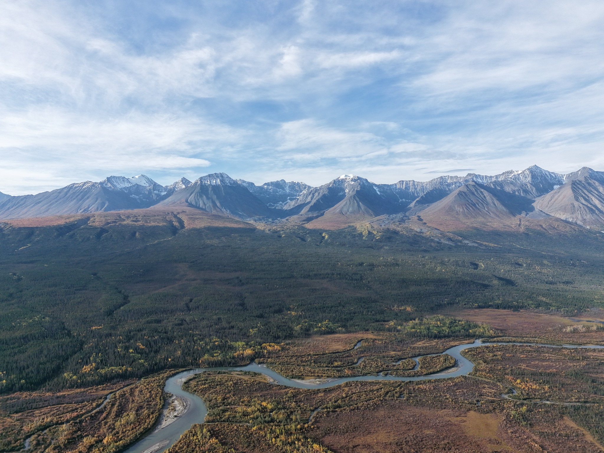
ROVEBOUND FIELD PHOTO · RIVER COUNTRY
The road is only one corridor.A Yukon river winding through broad mountain country — movement here has always followed more than asphalt.
ROVO · YUKON INTELLIGENCE
Ask before you choose the road.
ROVO can use Rovebound’s structured Yukon layer to compare routes, shape a short Arc and explain what still needs live verification. It should never invent current road, ferry, border, weather or cultural claims.
Good moment to ask: after learning the place, before committing to a route.
Yukon route intelligence · current conditions stay verification-dependent.
SIX ROUTES · ONE YUKON
Signature Loops & Edge Routes.
Each route stays focused on the story, shape and checks that matter. The Arc Engine handles the real dates, road reality, budget and logistics underneath.
01
EDGE ROUTE · REMOTE GRAVEL
North Canol Road
Johnson’s Crossing → South Canol → Ross River → seasonal Pelly crossing → North Canol
A deliberately honest route name: Johnson’s Crossing to Ross River is the South Canol. The remote North Canol begins beyond Ross River after the seasonal Pelly River crossing. Together they form one of Rovebound’s most demanding Yukon road stories.
Whitehorse → Dawson City → George Black ferry → Poker Creek → Tok
Dawson gives way to a high ridgeline road and Canada–U.S. crossing. The route depends on seasonal road, ferry and border operations, so Rovebound never treats it as a guaranteed static connection.
~6-day starting shapeDawson chapterInternational
VERIFY BEFORE YOU COMMIT
George Black ferryPoker Creek hoursRoad conditionsPassport
Dawson area → Tombstone → Eagle Plains → Arctic Circle
The Dempster is long, unpaved and exposed, with limited services and a landscape that changes rapidly as you move north. This version reaches the Arctic Circle; longer Arcs can continue farther when time and current logistics support it.
Whitehorse → Jake’s Corner → Atlin, British Columbia
Atlin is not in Yukon; that is part of why the route belongs here. Rovebound should follow coherent landscapes rather than administrative boundaries. It is a quieter Southern Lakes edge route into northern B.C. and Taku River Tlingit territory.
A shorter Arc that proves Rovebound is not only about distance. Lakes, small communities and side roads create a complete story close to Whitehorse — ideal for a day-plus escape or a slower local weekend.
Yukon interior becomes coastal Alaska and the Inside Passage before returning through the South Klondike corridor. Haines–Juneau–Skagway ferry legs depend on actual Alaska Marine Highway sailings and availability; they are never guaranteed by a static itinerary.
Each route is a story seed, not a tour package. DAKEYI helps shape your Yukon route around your dates, budget, party, transport, interests and current conditions. If live verification is slow, Rovebound can still show a provisional route without pretending unresolved safety or logistics checks have passed.
Each season creates a genuinely different trip. The landscape, light and conditions remain the reason to go.
EXPERIENCE THE YUKON DURING THE
Land of the Midnight Sun
June and July bring extremely long daylight across Yukon. North of the Arctic Circle, the sun can remain above the horizon continuously around the solstice; farther south, the days are still extraordinarily long without technically being 24-hour sun.
Rovebound angle: longer light can expand road days — but it does not expand your alertness. Build rest into the Arc.
EXPERIENCE THE YUKON DURING
Winter Wonderland & Aurora Lights
Aurora viewing is commonly possible from roughly mid-August through mid-April when nights are dark enough. Winter also changes road, daylight, cold-weather readiness and activity logistics completely.
No guarantees: aurora depends on solar activity, darkness and clear skies. ROVO should never promise a display.
EXPERIENCE THE YUKON DURING
Golden Fall (Autumn)
Fall colour arrives early in the North. Peak timing varies with latitude and weather: northern areas can turn in late August, while the Whitehorse region often peaks around mid-September.
Rovebound angle: fewer daylight hours and colder nights make the same road feel more deliberate — often with spectacular colour as the tradeoff.
Season context verified against official Travel Yukon seasonal guidance. Exact weather, daylight, aurora probability, road and operating conditions remain current-data questions.
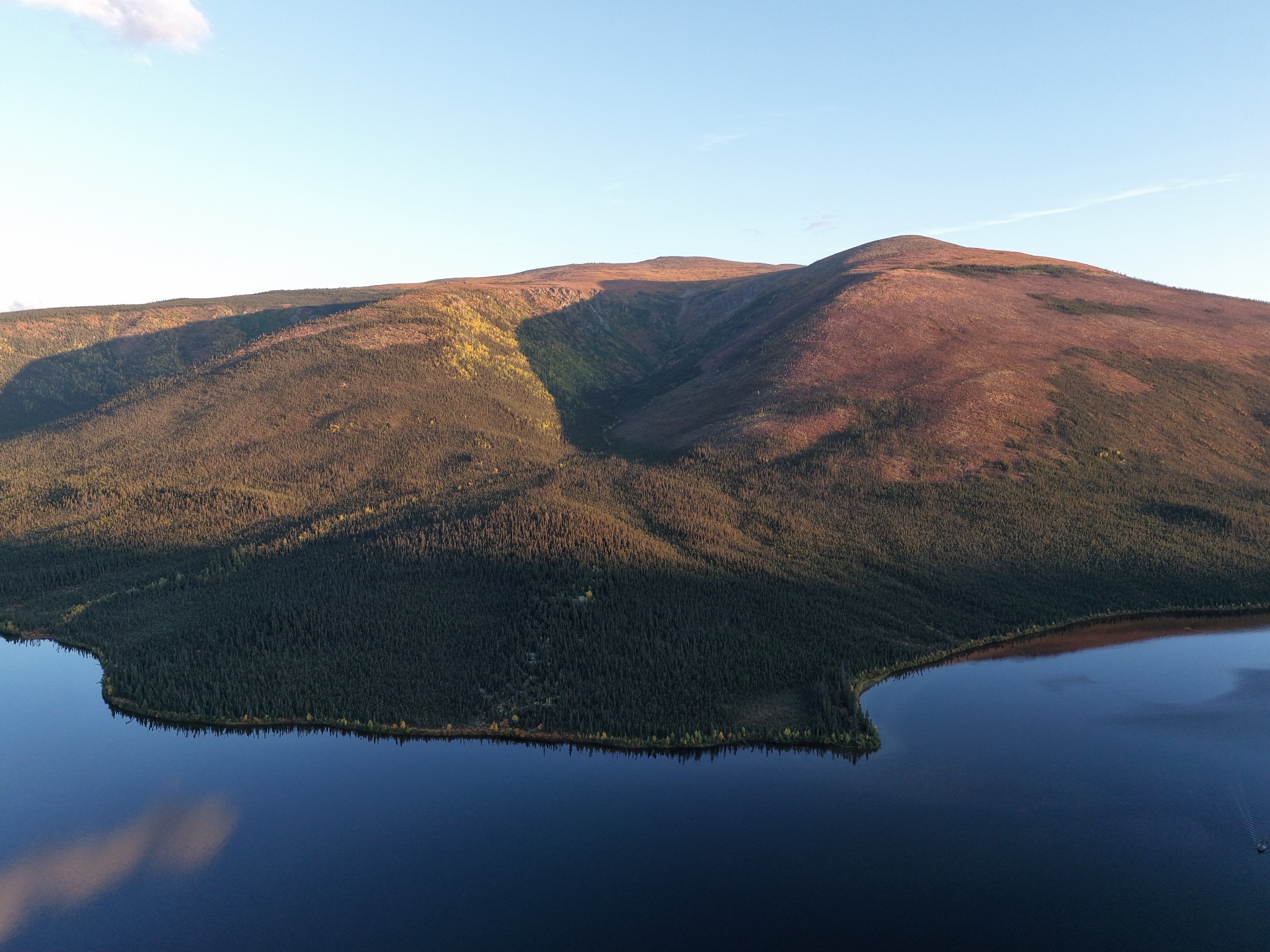
ROVEBOUND FIELD PHOTO · MOUNTAIN WATER
Choose the light. Change the story.Lake, forest and steep peaks — the same landscape can feel completely different as the Yukon season turns.
YUKON FACTS · BUILT FOR CURIOSITY
Facts that make you want to move.
Not trivia for trivia’s sake. Each fact should make the world feel larger or challenge an assumption about what travel has to look like.
A ROAD IS OPTIONAL.Old Crow is Yukon’s only community without road access. Not every Arc needs asphalt.
SOME JOURNEYS ARE OLDER THAN HIGHWAYS.The Chilkoot corridor was an Indigenous travel and trade route before Gold Rush stampeders crossed it.
THE “DESERT” ISN’T REALLY A DESERT.Carcross’s famous sand landscape is glacial in origin — proof that first impressions deserve a second question.
THE HIGHWAY NEEDED LOCAL KNOWLEDGE.Official Alaska Highway histories record First Nations guides and local knowledge helping wartime construction crews.
THE STORY DOESN’T STOP AT A BORDER.Traditional territories, families, wildlife migrations and historical routes extend across modern Yukon, Alaska, B.C. and the NWT.
GOVERNANCE IS PART OF THE PRESENT.Eleven Yukon First Nations operate under modern Final and Self-Government Agreements.
BEFORE YOU FALL IN LOVE WITH IT
Practical Yukon.
Rovebound separates stable route knowledge from live conditions. A beautiful story is not permission to pretend a road, ferry, border or weather window is currently safe or available.
ROADS + FUEL
Distance is part of the route.
Remote corridors can have long service gaps. Fuel range, tire readiness and road surface belong in the Arc before departure.
CELL + EMERGENCY
Do not assume coverage.
Remote travel should account for dead zones, emergency communications, food/water buffer and the possibility that help is far away.
BORDERS + FERRIES
Some roads depend on more than roads.
International loops need current border requirements. Mountains Become Ocean depends on actual Alaska Marine Highway sailings and availability.
CAMPING + LODGING
Keep flexibility, not ambiguity.
Campgrounds, public-land travel and small-community lodging all benefit from checking current rules, operating dates and availability.
Current road, wildfire, weather, border, ferry, closure and operating-status claims require authoritative live verification. If Rovebound cannot verify them, it should say so.